Let me show you around
Morrison
A tiny Jefferson County town at the mouth of Bear Creek Canyon, below Red Rocks Park. Small frame, brick and sandstone houses from the 1870s and 1880s line the side streets off Bear Creek Avenue, the main street, and Red Rocks Park is next door.
Live listings on compass.com. Send me any address and I’ll tell you what to look for.
Winter sun
Which driveways stay iced in December and which back yards keep the afternoon. Worth knowing before you fall for a house.
See how the winter sun falls on Morrison (opens in new tab)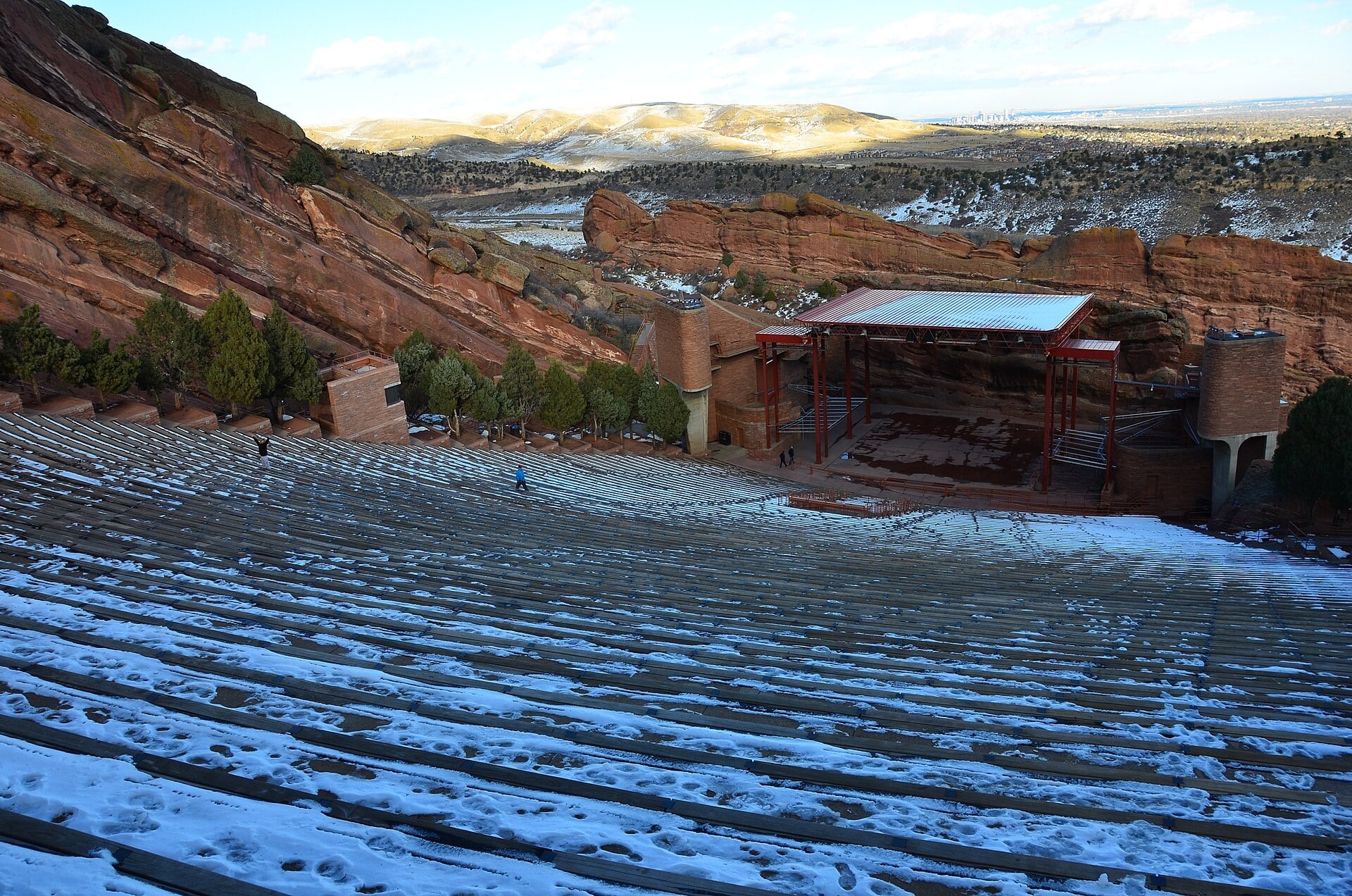
Living in Morrison
Morrison is its own town in Jefferson County, about 20 miles southwest of downtown Denver, where Bear Creek leaves the foothills. Red Rocks Park is right next door, the Dakota Hogback and Dinosaur Ridge rise just east of town, and Highway 8 and Highway 74 meet in the middle of town. It's small: about 1.6 square miles and 396 people at the 2020 census, sitting at 6,368 feet.
A stonemason's town
George Morrison, a stonemason, came to the Mount Vernon area around 1859 and quarried the stone and lime that gave the town its first buildings. He platted the town in 1874, started the Morrison Stone, Lime, and Town Co. on Bear Creek, and helped bring the Denver, South Park and Pacific Railroad out the same year. The town incorporated in 1906, and the last scheduled train ran in 1925.
Old houses on short side streets
Downtown and a few of the streets around it make up the Morrison Historic District, listed on the National Register in 1976 with 68 buildings and sites. Off Bear Creek Avenue, Stone, Market, Spring and Canon Streets, Mt. Vernon Avenue, Beckett Lane and South Park Avenue are lined with houses dated from the early 1870s through the 1920s, with the 1875 sandstone schoolhouse on Spring Street among them. A lime kiln from around 1878 made the mortar in many of the houses still standing. One was built around 1872 for railroad crews, and a few were moved back in 1926 when Highway 8 came through.
Keep the zip code in mind. Morrison's 80465 covers roughly 5,000 addresses, including Turkey Creek Canyon and land south of town, so a listing with a Morrison address may be in unincorporated Jefferson County. If you want to live in the town itself, confirm which side of the line the house is on.
Bear Creek Avenue and the patios
Bear Creek Avenue is the main street, a few blocks of old storefronts such as the 1876 native stone hardware building at 209 and a brick bank from around 1880 at 401. The Morrison Inn, at 301, has been pouring margaritas and serving Mexican food since 1979, and it added its mountainside patio in 1987. Around the corner, Red Rocks Beer Garden fills an 1870 cottage at 116 Stone Street, serves only Colorado-made food and drink, and has a patio of about 3,000 square feet. East of town on Highway 8, The Fort opened in February 1963 in an adobe building made of more than 80,000 handmade bricks. It's on the National Register and is known for buffalo, elk and quail. The Bear Creek Trail runs through town.
Red Rocks and the dinosaur ridge
Denver bought Red Rocks Park from John Brisben Walker in 1928, and it's part of the Denver Mountain Parks system, with 659 acres in its landmarked area. Civilian Conservation Corps crews built the amphitheatre, designed by Burnam Hoyt and in use since 1941, and five of the park's trails are for walkers only. If you buy within sight of the park, expect show-night traffic on the roads into town all summer.
In 1877 Arthur Lakes found the first remains of Stegosaurus and Apatosaurus near Morrison, and the rock layer known as the Morrison Formation took the town's name in 1896. Dinosaur Ridge, on West Alameda Parkway, has a paved 1.1 mile walk past more than 250 fossil tracks.
Roads in and out
Highway 8 starts at an interchange with US 285 south of town, runs north through Morrison, then turns east as Morrison Road, crossing C-470 and Kipling on its way to Wadsworth Boulevard in Lakewood. Highway 74, Bear Creek Canyon Road, heads west from town toward Evergreen.
Creeks and floods
Bear Creek runs through town. The railroad depot was abandoned after the 1933 flood, and another flood hit in 1938. If a house sits near the creek, check its flood zone and insurance cost before you write an offer.
FAQ
Is Morrison part of Denver?
No. Morrison is its own town in Jefferson County, about 20 miles southwest of downtown Denver. Denver does own Red Rocks Park, right next to town.
Is every Morrison address inside the town?
No. The 80465 zip code covers about 5,000 addresses, including Turkey Creek Canyon and land south of town, so many are in unincorporated Jefferson County.
How old are the houses in town?
The side streets off Bear Creek Avenue have houses dated from the early 1870s through the 1920s.
Is Morrison a historic district?
Downtown and nearby streets make up the Morrison Historic District, on the National Register since 1976 with 68 buildings and sites.
Is there flood risk?
Bear Creek runs through town, and the town flooded in 1933 and 1938. Check the flood zone on any house near the creek.
How do you get to Denver from Morrison?
Highway 8 connects to US 285 south of town and to C-470 and Morrison Road to the east, which runs into Lakewood.
Where do you eat in Morrison?
The Morrison Inn on Bear Creek Avenue has served Mexican food since 1979, Red Rocks Beer Garden is in an 1870 cottage on Stone Street, and The Fort sits east of town on Highway 8.